Storms threaten burn scar areas at risk of mudslides and flooding
By The Malibu Times · Wed Feb 05 2025
Caltrans shuts down Pacific Coast Highway as back-to-back atmospheric river storms raise risks in wildfire-affected areas; officials urge residents to prepare for potential evacuations
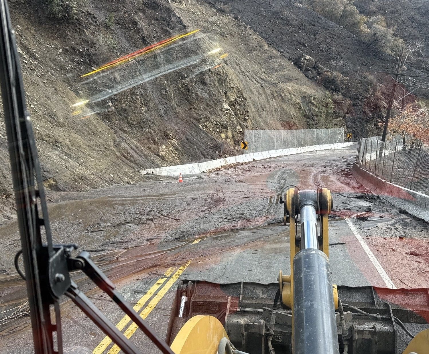
Caltrans closed the Pacific Coast Highway (PCH) on Tuesday at 3 p.m. as a precautionary measure ahead of a pair of incoming atmospheric river storms. The closure spans from Chautauqua Boulevard in Los Angeles to Carbon Beach Terrace, targeting areas at risk of mud and debris flows from the Palisades Fire.
Law enforcement officers are stationed at closure points, allowing access only to essential workers involved in recovery efforts along PCH. Caltrans geotechnical engineers will assess the slopes and canyons on Friday to determine if the highway can safely reopen.
As the wildfire-affected communities anticipate much-needed rainfall after months of drought, the incoming storms bring new risks to areas recently impacted by the Palisades and Eaton fires. These fires, which burned for nearly a month and claimed 29 lives, were only contained days ago, leaving the region vulnerable to potential flooding and landslides.
The first storm system arrived Tuesday night, bringing intermittent rain through Wednesday morning. While forecasters do not expect it to reach burn scar thresholds for debris flows, the National Weather Service (NWS) warns that canyon roads and other sensitive areas could still see minor mudslides and erosion. The heaviest rain is forecasted to occur midday Thursday through early Friday morning, with some areas potentially receiving up to three inches of rain.
“The incoming storms are just the second significant rain events of the winter,” the NWS stated. “There is high confidence in widespread periods of rain through Friday.” Coastal and valley regions are expected to receive about an inch of rainfall, with higher totals in foothills and mountains. Officials continue to monitor conditions closely, as even moderate rainfall can destabilize hillsides weakened by fire damage.
Officials across Los Angeles County are taking proactive steps to mitigate storm-related risks. Emergency response teams have been working to clear debris basins, reinforce infrastructure, and ensure that residents have access tonecessary resources.
“Los Angeles County has been working around the clock to prepare for this storm,” said Supervisor Lindsey Horvath. “I urge all residents to take this time to prepare—secure your property, use sandbags where needed, and stay informed.”
Peak rainfall for the first storm started last night and will remain through Wednesday at noon. Early projections suggest a second storm arriving Thursday could bring heavier rainfall and increased risks for debris flows in burn scar areas.
Residents in areas affected by the Palisades and Franklin fires are urged to take precautionary measures now. The LA County Department of Public Works has set up sandbag distribution locations, including:
- La Costa Post Office Parking Lot (21229 PCH, Malibu) – Pre-filled and empty sandbags
- Fire Station #70 (3970 Carbon Canyon Road, Malibu) – Empty sandbags
- Fire Station #88 (23720 Malibu Road, Malibu) – Empty sandbags
- All LA County Fire Stations – Call ahead to check availability
Plastic sandbags are prohibited in Malibu, and residents are advised not to take sand from beaches due to environmental restrictions.
The NWS advises residents to be aware of potential power outages and to use extreme caution when driving. Under California law, motorists must come to a complete stop at any malfunctioning traffic signals. Authorities also urge residents in burn scar areas to prepare for possible evacuations and to have emergency supplies readily available.
California Emergency Response Efforts
In anticipation of the storms, the California Governor’s Office of Emergency Services (Cal OES) has deployed critical resources, including swift water rescue teams, to high-risk areas near burn scars. Pre-positioned assets in Los Angeles County include:
- 6 OES Fire Engines
- 7 Local Government Engines
- 4 Local Government Bulldozers
- 1 Local Government Loader
- 2 Local Government Helicopters (with rescue swimmers)
- 2 Local Government Dispatchers
- 2 Local Government Hand Crews
- 1 Local Government Swift Water Rescue Team
- 4 Local Government Urban Search & Rescue Companies
- 1 Local Government Regional Task Force
Officials warn that these storms may lead to power outages, flooding in low-lying areas, and debris flows on roadways. Residents are urged to take precautions, such as securing outdoor furniture, clearing rain gutters, and avoiding unnecessary travel. Authorities also remind drivers never to attempt crossing flooded roads, as water depths can be deceiving and dangerous.
Stay Informed
Residents are encouraged to stay updated through official sources:
- LA County Sandbag Locator Website: DPW.LACounty.gov/dsg/sandbags
- California Emergency Preparedness: Ready.ca.gov
- National Weather Service – LA/Oxnard Forecasts
- City Emergency & Traffic Alerts
With heavy rainfall expected through the end of the week, officials continue to urge preparedness and caution. Residents in vulnerable areas should remain vigilant and ready to act should conditions worsen. For those living in burn scar regions are advised to plan ahead, stay informed, and be ready to evacuate if necessary.