Palisades Fire Update: Friday, January 10
By The Malibu Times · Fri Jan 10 2025
Fire Overview as of 6:24 a.m.
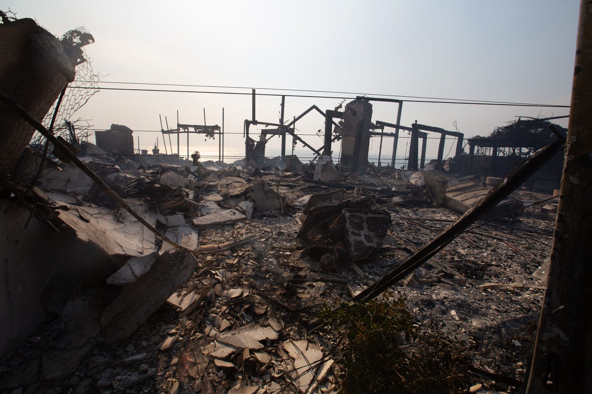
The Palisades Fire, now the largest and most destructive wildfire in Los Angeles County's history, has burned 20,438 acres and remains only 6% contained as of early Friday morning. The fire, driven by strong winds and challenging topography, has already decimated more than 5,000 structures, including homes and businesses, and has prompted widespread evacuations.
Authorities report that the fire continues to spread due to short-range spotting and wind gusts reaching up to 40 mph. Although winds are expected to moderate slightly over the weekend, weak to moderate Santa Ana winds are forecast to persist into next week, with a risk of stronger winds by Tuesday. Critical fire weather conditions remain a significant concern.
Impact on Communities
The Los Angeles Unified School District canceled all classes Friday, and residents are advised to avoid nonessential travel to allow firefighters and emergency crews to operate effectively. In addition to the Palisades Fire, four other wildfires, including the Eaton Fire in Altadena and Pasadena (13,000 acres, 0% contained) and the Kenneth Fire near Woodland Hills (1,000 acres, 35% contained), are ravaging the region. Combined, these fires have scorched over 54 square miles of land.
Tragically, the fires have claimed the lives of at least 10 people, including one confirmed fatality in Malibu.
Federal and State Assistance
President Joe Biden has pledged full federal support for wildfire response in Southern California, including covering costs for debris removal, emergency shelters, and first responders’ salaries for 180 days.
Utility and Infrastructure Updates
Southern California Edison and SoCalGas have implemented service shutdowns in high-risk areas, including parts of Malibu, to prevent further hazards. Approximately 15,000 customers are without gas service, and residents are under a mandatory boil water advisory in multiple areas, including Malibu and Pacific Palisades. All gas stations in Malibu are currently non-operational.
Traffic and Evacuations
Key roads, including Pacific Coast Highway and Malibu Canyon, remain closed, with detours in place. The Los Angeles County Sheriff’s Department is strictly enforcing evacuation orders, and repopulation efforts are not expected within the next 72 hours.
Road Closures (Hard Closures):
- PCH & Entrada – Westbound
- Lost Hills/Las Virgenes – Southbound
- Topanga/Mulholland – Southbound
- Old Topanga/Mulholland – Southbound
- Mulholland/Stunt – Southbound
- Malibu Canyon/Piuma – Southbound
- PCH/Malibu Canyon – Westbound and Eastbound
- Malibu Road/Webb Way – Eastbound
- Mulholland/Malibu Canyon – Eastbound
- Piuma/Woodbluffs – Full closure
- Dry Canyon Cold Creek/Mulholland – Full closure
- Mulholland/Malibu Canyon – Southbound
Drivers should avoid these areas and follow detour signage.
Arson Investigation
The Los Angeles Police Department has arrested a suspect in connection with the Kenneth Fire near Woodland Hills. Authorities are investigating potential links to other fires in the area.
Support for Residents
Evacuation centers have been established at several locations, including El Camino Real Charter High School and the Pasadena Convention Center. Animal shelters are available for displaced pets, and donation drives are underway to assist affected families.
Neighboring Community Evacuations:
- Evacuation Orders:
DRY-U026-A, LOS-Q0767, MTN-U028, RMB-U030-A/D, RRC-U027, SAN-Q1395-B, SAN-Q1396-B, SDP-U029, SSM-U010-A/B, TOP-U001–TOP-U009 - Evacuation Warnings:
CAL-C405 through CAL-C415, DRY-U026/B, MCR-U021-A, RMB-U030-C, SAN-Q1395-A/B
Evacuation Centers:
- El Camino Real Charter High School
5440 Valley Circle Blvd, Woodland Hills, CA 91367 - Pasadena Convention Center
300 E Green St, Pasadena, CA 91101 - Westwood Recreation Center
1350 S Sepulveda Blvd, Los Angeles, CA 90025 - Stoner Recreation Center
1835 Stoner Ave, Los Angeles, CA 90025 - Calvery Community Church
5495 Via Rocas, Westlake Village, CA 91362
Repopulation:
No repopulations are expected to be scheduled for atleast the next 72 hours.
Residents are urged to stay informed through local radio stations like KBUU 99.1 FM and official websites, including Malibu City Updates, CAL FIRE and Genasys Protect.
Key Safety Reminders
- Follow evacuation orders immediately to protect lives.
- Avoid returning to affected areas until it is declared safe.
- Use boiled or bottled water in areas under advisory.
For assistance or to report issues, contact the City of Malibu Emergency Hotline at (310) 456-9982 or SoCalGas at 1(800) 427-2200.
Crime:
LA County Sheriff is firmly enforcing mandatory evacuations orders. A misdemeanor will be issued to anyone found in an area that is subject to an evacuation order. Sheriff’s Crime Suppression Unit is conducting active patrols in all evacuation areas.
Animal Shelters:
Large Animal Shelters:
- Los Angeles Equestrian Center
480 W Riverside Dr, Burbank, CA 91506 - Industry Hills Expo
16200 Temple Ave, City of Industry, CA 91744 - Pomona Fairplex
1101 W McKinley Ave, Pomona, CA 91768 - Pierce College Equestrian Center is at capacity
Small Animal Shelters:
- Agoura Animal Care Center
29525 Agoura Rd, Agoura Hills, CA 91301 - Pasadena Humane Society
361 S Raymond Ave, Pasadena, CA 91105
Donations for Those Impacted by the Fire:
The Boys & Girls Club of Malibu has established an emergency relief fund to help those impacted by this disaster, at donate.onecause.com/bgcmalibu/donate. The public is asked to direct donations here, and not to bring donations of food, clothing, etc. to the fire zone.