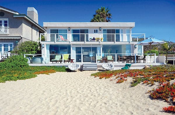
At the monthly California Coastal Commission meeting in Long Beach last Thursday, two commissioners formally appealed the City of Malibu’s approval of a development permit for the Klein Family Partnership beachfront property at 30708 Pacific Coast Highway. They found five “substantial issues” with the project, which they decided to hold up as an example to the rest of the state.
The proposed project would involve demolishing a 3,153-square-foot single-family home built in 1968 and replacing it with a new, 6,120-square-foot single-family home and an attached garage. Because the project is so extensive, coastal staff consider it to be new development—not grandfathered into previous regulations. They say the property is vulnerable to coastal hazards and flooding and point out that it is in the Broad Beach Geologic Hazard Abatement District (BBGHAD).
The house, located at the very end of Broad Beach next to Trancas Creek, is apparently used as an investment property. Its online listing with “Malibu Luxury Vacation Homes” states a rental rate of $1,000 to $3,000 per night for the five-bedroom, and four-bath home “available for vacations, family reunions, corporate retreats, special events and location filming.”
Coastal regulations specify that “new development on a beach needs to be located outside of areas where erosion, inundation and wave uprush” could occur for the next 100 years. If that’s not possible, new development needs to be elevated above the base flood elevation defined by FEMA and set as far back as possible.
The commission had a number of problems with the city’s approval of the development, but failure to use the latest numbers on sea level rise topped the list. The Klein’s engineering report from Dec. 17, 2017, assumed 18 inches (1.5 feet) of sea level rise by 2100 and made all of its calculations about wave run-up based on that.
The engineer used by the City of Malibu approved the number, saying it conformed to the coastal commission’s 2015 Sea Level Rise Policy Guidance. Coastal disagreed, saying the project failed to use the region-specific sea level rise projections or consider its updated figures published in 2018, which indicate a minimum sea level rise of 66 inches.
“The 66-inch projection is significantly higher than the 18-inch (1.5 ft.) sea level rise projection used in the applicant’s December 2017 Wave Uprush Study and Coastal Engineering Report that the City relied on in its CDP action,” the staff report stated. “The difference is more than 4.65 feet, which is significant in determining the required setback, finished floor elevation, and safety of the proposed structure from extreme events and sea level rise.”
Coastal commented that the approved project would be “vulnerable to coastal hazards over its expected life.” They also said the city failed to demonstrate whether the development (including all accessory development such as decks, swimming pool, etc.) was sited as far landward as possible and designed to minimize risks.
“The newest best available science on sea level rise indicates that in this area, sea levels may rise between 3.3 and 10 feet by the year 2100, which is significantly higher than the level analyzed in the City’s findings,” the report continued. “Rise is projected to be 5.5 feet by 2090 and 6.8 feet by 2100 in the Santa Monica area.”
The commission stated the city had set a precedent with its approval of this project, with potential statewide ramifications, by not requiring applicants to use the best available science with regard to sea level rise projections.
“Under the certified Local Coastal Plan (LCP), beachfront development is required to be sized, sited and designed to minimize risks from wave hazards that are expected to increase over time, ensure maximum public access and minimize adverse effects on shoreline sand,” they wrote. “The way this permit is resolved will affect future redevelopment of homes on beachfront lots in the city. This is an important precedent not just for the city, but also statewide.”
Other “substantial issues” that coastal had with the project included its sensitive location within the ESHA buffer for Trancas Creek, where the city approved a mere 4.75-foot setback from the banks. Coastal found no evidence of whether the development had been sited and designed to withstand future creek erosion and flooding; as well as minimize impacts on ESHA.
In addition, they said the city’s approval didn’t properly utilize the “stringline” provision of the LCP, which would have resulted in this development sticking four feet further out than the property next door.
Coastal points out the Malibu LUP requires all new ocean-front developments to make an Offer-to-Dedicate (OTD), an easement for lateral public access, which this project did not.
In addition, the agency was upset that some drawings appeared to show perimeter walls surrounding the property which aren’t allowed on the ocean side, because they can function as “shoreline protective devices.”

