Malibou Lake residents participate in the 2025 Flood Management Plan Update
By Barbara Burke · Fri Aug 02 2024
County Public Works provides overview of the plan’s process, which is integral to insurance program
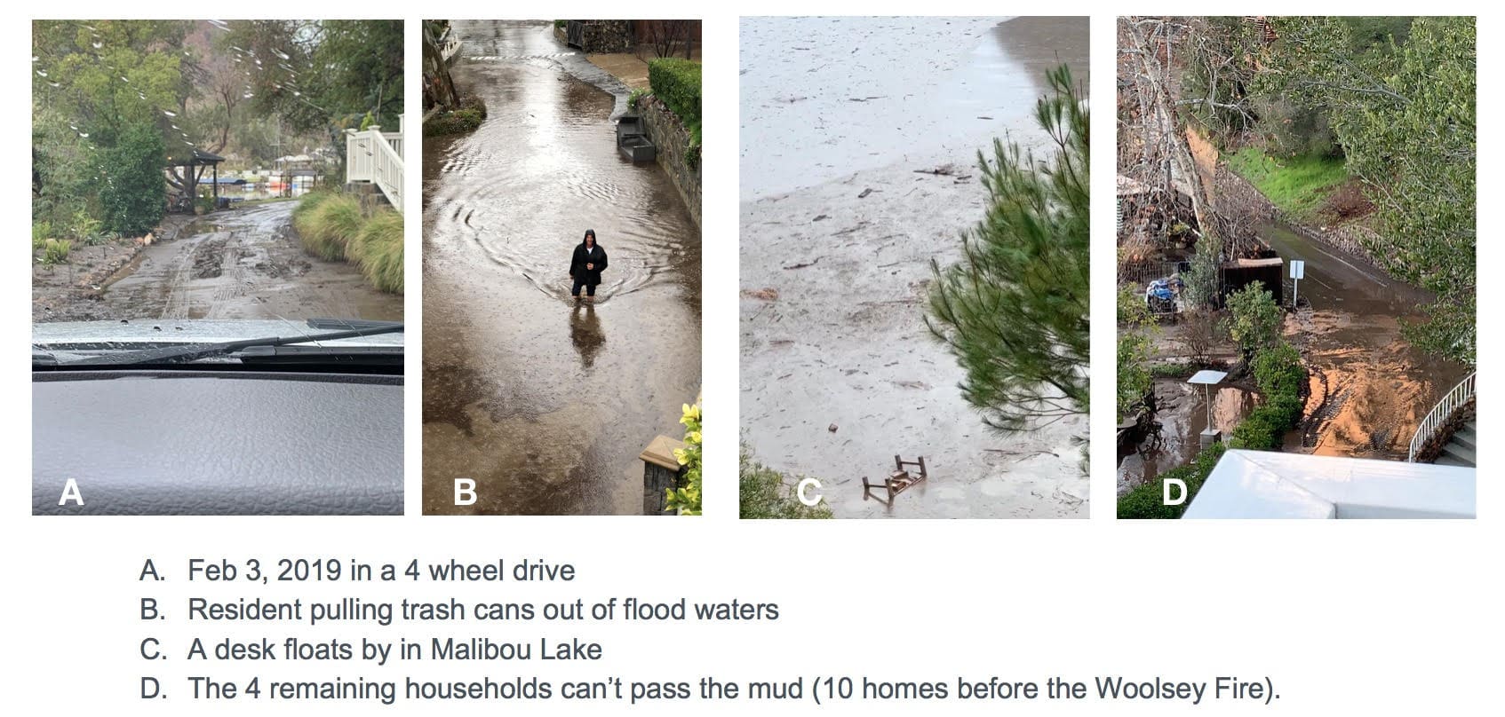
"As the recipient of 59 percent of the watershed's waters, Malibou Lake is vulnerable to fast water during rainfall/flood conditions,” Shannon Ggem of Malibou Lake Mountain Club explained. “The 2018 Woolsey Fire left bare soil for 68 upstream miles, and the sediment washes down, filling the basin, causing flooding to the historic community's streets and homes."
Residents of Malibou Lake gathered on July 18 for a presentation by the Los Angeles County Public Works Department regarding the updating of the county’s Floodplain Management Plan due in 2025, which is integral to the National Flood Insurance Program.
“The National Flood Insurance Program is a federal program and homeowners can get flood insurance if their community is part of the NFIP — flood insurance is required for federally backed mortgages and disaster assistance,” David Pohl, a department civil engineer explained. “A community is required to have a floodplain management plan updated every five years and this meeting is the first step in the process of updating Malibou Lake’s 2025 plan update.”
A community rating system is a voluntary program with the NFIP, he stated. A floodplain management plan consists of a strategy of programs, projects, and measures aimed at reducing the adverse impact of the flood hazard in a given community. Pohl said, adding that “the FMP mission statement is to protect life, property, the economy and the environment of unincorporated Los Angeles County by identifying and communicating risks and sustainable actions to reduce flood hazards and thereby enhance a community’s resilience.”
The responsibility for flood hazard mitigation lies with many actors — the Public Works Department, local governments, communities and property owners, he noted. The goals of the FMP are to enhance community resilience to the impact of flood hazards while maximizing opportunities for local water sources.
Pohl noted that the Department informs residents and stakeholders what flood risks they face, based on the best available data and science. The next step in the process is to try to increase the resilience of infrastructure and critical facilities from flood hazards. In developing the plan, the department accounts for flood risk in land use and planning, while also preserving, enhancing, or restoring the natural environment’s floodplain functions without increasing flood hazards.
Part of the calculus in defining flood risks includes conducting a repetitive loss area analysis so as to develop the mitigation plan for areas, such as Malibou Lake, with multiple losses from flooding. Repetitive loss areas are determined by using insurance claims, FEMA flood zones hazard areas, flood depth mapping, topographic maps, and other flood maps, Kohl noted.
Malibou Lake is a repetitive loss area and an FMP committee, composed of representatives from local government, nonprofit groups, town councils, members of the board of directors for Malibou Lake Mountain Club, and members of the general public.
Locals attending the informational session noted that the workshop was informative and constituted a good first step in providing residents of Malibou Lake with a voice in the process.
There are several problem areas that are prone to repetitive funding, Pohl noted, referring to a map showing which parts of Malibou Lake and its surroundings are problematic, and stating that, starting in 2022, FEMA employs a risk rating, based on available data, and the rating and factors unique to a parcel determine flood risk rates for a given home or company.
Addressing the insurance issues concerning the FMP further, Patricia Wood, Senior Civil Engineer, noted that FEMA also uses disaster modeling in computing flood insurance.
How the locals view flood mitigation
“Some of the homes near where I live have experienced flooding and sometimes, the rain is so intense that the fire department has to close access to the gate on Mulholland,” Malibu Lake resident Mike Kerze said. “One used to be able to fish for trout and catfish, but not now. At one point, the rain was so high that the fence between Malibou Lake and Paramount Ranch was damaged because there was eight to nine feet of mud there.”
Kerze noted that areas in the community near the lake are currently being dredged and the department is conducting sewer work near the Medea Bridge. “The bottom of the dam area holds between 20 to 30 feet of sediment,” he said. “My dream is that they dredge the lake to a sufficient degree that we can reintroduce trout and blue gills.”
The meeting was the first step in the process of composing the 2025 plan, Kohl explained, noting that there will be future opportunities for the community to review the FMP once a draft plan is completed.
For more information, readers can go to pw.lacounty.gov/wmd/nfip.