City Hall meeting held to explain Malibu Coastal Vulnerability Assessment
By The Malibu Times · Sun Nov 26 2023
The presentation included an overview of the assessment process as well as the findings in the draft report
By Barbara Burke
Special to The Malibu Times
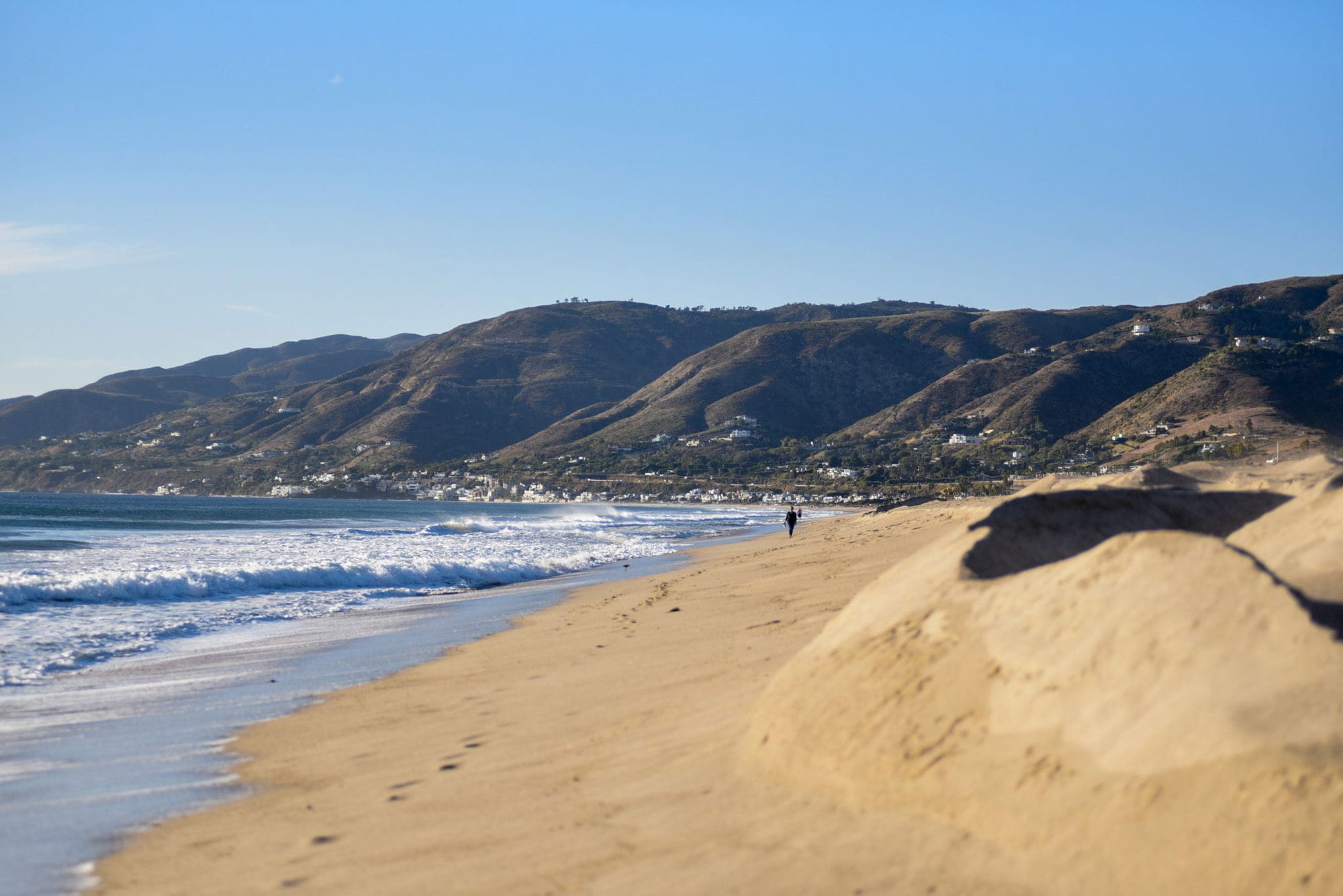
The Malibu Coastal Vulnerability Assessment was undertaken to provide the community with details concerning existing coastal conditions in Malibu and to highlight the future vulnerability of the city’s built and natural coastal resources and assets under various projections regarding possible sea-level rise, tidal inundation, storm flooding, and coastal erosion.
The report addresses projected conditions in the near-term, defined as the present until 2049; the mid-term, defined as from 2050 until 2080, when the potential sea-level rise is 2.5 feet; and the long term, from 2080-2100, when the potential sea level rise is 6.6 feet. Importantly, the first date in the date range assumes rapid ice sheet loss on Antarctica, while the late date assumes emissions continue as usual with no ice sheet loss, thereby delaying the extent of potential sea level rise.
Environmental sustainability staff and consultants from ESA, an environmental consulting firm, presented a draft assessment report to community members at a meeting in City Hall on Nov. 14, and in an online meeting on Nov. 16. The presentation included an overview of the assessment process as well as the findings in the draft report. The study area includes Malibu’s shoreline that stretches approximately 22.6 miles from Nicholas Canyon to Topanga Beach and includes the lower Trancas and Zuma canyons and low-lying areas around the Malibu Lagoon.
“Our goal is to take the residents’ comments and concerns from these meetings wherein we are seeking information and feedback from community members,” said Yolanda Bundy, director of the Environmental Sustainability Department. “Then, after considering feedback and making necessary changes to the draft report, we will have a second community meeting in early 2024. After that, the staff will make any necessary changes and the assessment will be addressed by the City Council.”
Citizens listened attentively as staff quickly reviewed historic flooding events and existing conditions, recounting coastal storms during El Nino seasons and king tides. Staff noted that with regard to data collection, an asset inventory was conducted, evaluating Malibu’s critical infrastructure, including communication towers, public facilities such as fire and public offices, energy assets, including electric meters, water assets such as sewer mains, sewer pump stations, and storm drain inlets and junctions, transportation assets, critical assets, such as fire hydrants and lifeguard towers, as well as recreation facilities. The study also took into account the Malibu area’s unique and fragile ecology, including environmentally sensitive habitat areas.
Then, those making the presentation discussed existing possible sea-level-rise adaptation strategies.
Approximately 31 percent of the Malibu coastline is protected by coastal armoring structures such as rock revetments and wooden or concrete sea walls. In that regard, the report cautions that although armoring provides protection to existing shorelines, it can also contribute to additional erosion and accelerate beach loss.
Other current adaptation methods are beach nourishment and installing temporary sand berms. The report notes that the LA County Department of Beaches and Harbors regularly builds berms to reduce winter flooding for lifeguard facilities, restrooms, and maintenance yards along the beach.
Those current solutions are not sufficient to address projected sea level rise, according to the study which utilizes a high carbon emission scenario for future decades.
Future tidal inundation, storm flooding, waves and erosion
“Future sea-level rise is expected to create a permanent rise in ocean water levels that would shift the water’s edge landward,” The draft report states. “Higher water levels would increase erosion of beaches and cliffs, and result in narrower beaches if no action is taken.”
The report also notes that “The combination of higher ocean water levels and beach erosion would mean that coastal storms will potentially cause greater flooding along the shore, because reduced beach width is less effective at reducing wave energy, and waves that break in deeper water and/or closer to shore will result in greater run-up.”
The report enumerated potential future hazard zones, noting that tidal inundation (non-storm) and groundwater levels affect low-lying areas adjacent to, but disconnected from tidal areas by high ground that is permanent. Coastal erosion affects the shoreline, beach and bluffs. When there is a 100-year coastal storm event, wave overtopping causes flooding in low-lying areas temporarily and there is creek flooding that eventually subsides, but can cause significant damage.
Coastal processes attributable to unaddressed beach and bluff erosion due to sea level rise versus using efforts to address erosion
As with any study, it’s best to carefully evaluate presumptions that are made. Here, the study characterized the full extent of potential impacts to Malibu assets from sea-level rise assuming erosion hazard zones under a “let it go, no beach nourishment” management scenario that assumes no management actions are taken and erosion is allowed to continue unabated into coastal development areas. In the alternative, the study also assessed “hold the line” scenarios that assume that management actions are taken to repair and replace damaged structures and construct new armoring to protect all existing development.
Left for future action by the City Council is the arduous task of attempting to define what management actions are feasible to address sea-level rise impacts. Of course, the issue of how to fund such actions is also left to the future.
The draft assessment also provides projections of shoreline and bluff erosion to compute beach width changes due to sea-level rise. With regard to potential maximum wave run-up attributable to sea-level rise, the study also assesses the Malibu and Paradise Cove piers’ potential wave exposure during extreme storm conditions. Finally, the study also takes into account that riverine flooding in rivers and creeks will increase due to higher sea-levels, which will cause water levels to back up in coastal rivers and limit river drainage to the ocean, causing floods.
Attendees’ questions
Audience questions included addressing personal circumstances, with one attendee stating, “I’m sure I’m not the only one that has been living on one of Malibu’s beaches since the 1970s and seen severe beach reduction. So, I wish someone would be the canary in the coal mine and tell me when I should sell my house as I want my son to inherit something when I die?”
Several attendees had more technical questions addressing the fact that in its 2022 projections, the National Oceanic Atmospheric Association (NOAA) has dropped its extreme level scenario utilized in the draft assessment as a metric to guide communities attempting to determine responses to sea level rise. The consultants and staff will adjust the language in the report to acknowledge that variation. Readers may wish to review NOAA’s discussion of that recent adjustment at: oceanservice.noaa.gov.
Planning Commissioner John Mazza noted that the Coastal Commission is asking those building in Malibu to provide 100-year sea level rise assessments, but the draft assessment mainly addresses a 77-year assessment to 2100. Again, staff and the consultants assured that they would address that in their next draft assessment.
Attendees also expressed confusion about how the City’s Coastal Vulnerability Study interfaces with other climate vulnerability assessments by the county, state, and federal agencies.
The answers to all the questions will be assessed by staff, and the assessment report will be modified, Bundy said.
Community workshop attendees comment on area-specific GIS maps
Then, attendees disbursed to review sub-area maps and provide comments regarding beaches in six delineated areas throughout Malibu. Each GIS map sets forth an area’s particular concerns.
Coastal erosion is the dominant hazard for sub-area A, which has parameters from Nicholas Canyon Beach to Point Lechuza, according to the study, which also notes that area’s vulnerabilities include a mix of residential development, open space on top of the bluffs and bluff-backed beaches. Sub-area B, defined as spanning from Point Lechuza to Point Dume, has vulnerabilities including erosion of blufftop development, and flooding and erosion of low-lying beach front development.
The area between Point Dume and Escondido Beach, comprising Sub-area C, has vulnerabilities including the erosion of residential development on the top of tall bluffs and some small pocket beaches. From Escondido Beach to Malibu Surfrider Beach, Sub-area D, has vulnerabilities that include more extensive residential development at or near beach elevations and the Pacific Coast Highway. Malibu Surfrider Beach to Topanga Beach, Sub-area E, has vulnerabilities, including beachfront residential development seaward of Highway 1 with narrow fronting beaches.
Many community members were appreciative of the city staff and consultants hosting the meeting and Bundy and Solishia Andico, environmental sustainability analyst for the City of Malibu noted that ESA and the city will review the public comments and concerns and develop a range of adaptation measures that can be taken to reduce the sea-level rise vulnerabilities identified in the report and the city will conduct more workshops to inform the public about those measures in order to gather community input and develop next steps in the planning process.
For more information: View the draft assessment report and the GIS map utilized at MalibuCity.org/coastal.