Rain and high surf threaten to worsen Malibu’s ongoing coastal erosion
By The Malibu Times · Fri Nov 13 2026
Waves could reach 12 feet Saturday; high surf advisory continues through Tuesday
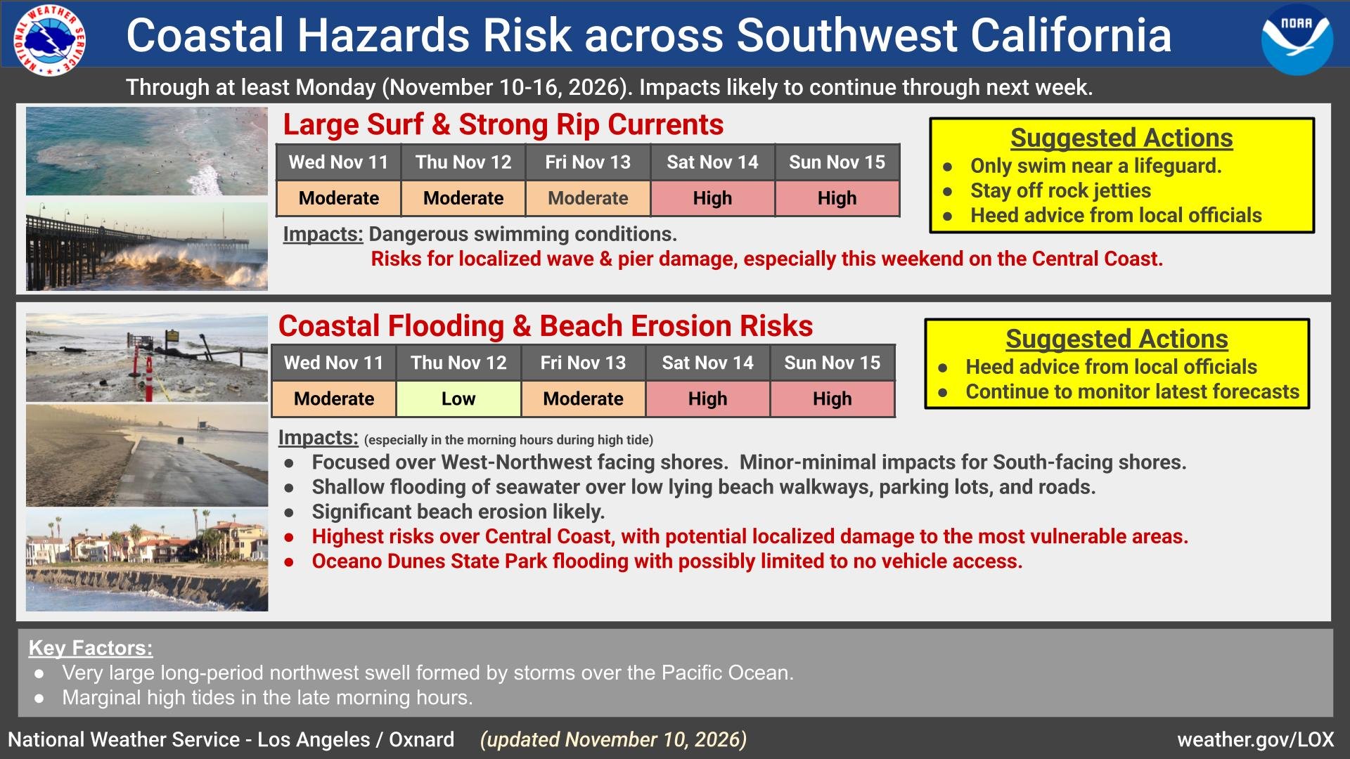
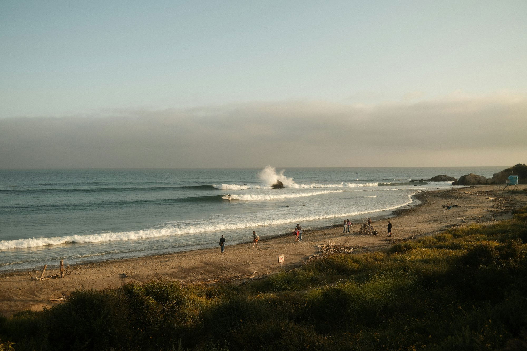
Rain returns to Malibu, Friday, Nov. 13, ahead of powerful ocean swells expected to bring dangerous rip currents, coastal flooding and the potential for moderate to significant beach erosion through the weekend. The largest waves and greatest coastal impacts are expected Saturday, Nov. 14. Although skies should clear for much of the weekend, hazardous ocean conditions will persist into next week, with another possible peak in surf impacts Monday.
A National Weather Service High Surf Advisory takes effect at 2 p.m. Friday and continues until 3 p.m. Tuesday, Nov. 17. A Beach Hazards Statement remains in effect until the advisory begins. Breaking waves are forecast to reach 4 to 7 feet Friday, build to 7 to 12 feet Saturday, then ease to 6 to 9 feet Sunday through Tuesday. West- and northwest-facing beaches will see the largest surf.
The incoming west-northwesterly swells could erode beaches and push seawater across normally dry sand and coastal walkways. In its Nov. 13–19 weather notice, the City of Malibu warned that moderate coastal flooding is possible, especially Saturday, and urged residents and visitors to keep their distance from the shoreline.
Powerful waves can sweep people off beaches and rocks, while rip currents can pull swimmers and surfers offshore. The weather service also warned that breaking waves could capsize small boats near shore.
On land, Friday’s forecast calls for morning showers and a slight chance of thunderstorms, followed by partly cloudy skies and a chance of afternoon showers. Temperatures will reach the mid-60s to around 70 degrees. Rain is expected Friday night, accompanied by southwest winds of 15 to 25 mph and overnight lows in the mid- to upper 50s.
The National Weather Service’s Malibu point forecast places the chance of precipitation at 80 percent Friday and Friday night, with one-tenth to one-quarter inch possible during each period. Totals will vary by location.
Rain could linger into early Saturday before giving way to a drier weekend, according to the city’s notice. Saturday should bring morning clouds followed by sunshine, with highs in the mid-60s to around 70. Sunday is expected to be partly cloudy, with highs in the mid-60s to lower 70s. Additional rain is possible Monday through Thursday.
While regional rainfall impacts are generally expected to be minor, isolated heavier showers could cause flooding on roads and in low-lying areas, along with minor rock and mudslides on canyon roads. Thunderstorms could produce lightning, small hail and brief heavy downpours.
Malibu officials urged drivers to watch for potential mud and debris flows while traveling through canyons and to use caution on wet roads and walkways.
Along the coast, the city advised beachgoers to stay out of the water during dangerous surf, keep off rock jetties and exposed rocks, and never turn their backs on the ocean. Those visiting beaches should remain near occupied lifeguard towers, maintain a safe distance from breaking waves and follow posted warnings.
Rain runoff adds another concern for anyone considering entering the ocean. Los Angeles County Public Health recommends avoiding ocean-water contact for three days after significant rainfall, particularly near flowing storm drains, creeks and rivers, where runoff can carry contaminants into coastal waters.